DOGAMI OPEN-FILE REPORT SERIES
Publication Preview

Open-File Report O-24-11, Improved Cascadia Earthquake Source Models for Tsunami Hazard Assessment, by Matthew Sypus and Kelin Wang; 64 p. report, geophysical model data, geometry data.
WHAT’S IN THIS REPORT?
This report describes the development of a suite of new Cascadia Subduction Zone (CSZ) megathrust source scenarios. Compared to previous Cascadia tsunami source models, several improvements are made. These improvements have been aided by the recent release of new data from the Cascadia Seismic Imaging Experiment 2021 (CASIE21), reinterpreted legacy seismic data, seismicity, and low-frequency earthquakes (LFE) in Episodic Tremor and Slip (ETS) events.
PUBLICATION DOWNLOADS
EXECUTIVE SUMMARY
This report describes the approaches used to construct megathrust source scenarios by integrating multiple datasets, the overarching goal being the eventual development of new probabilistic tsunami hazard analyses for Cascadia. Compared to previous Cascadia tsunami source models, several improvements are made. The megathrust geometry model is much improved, owing mainly to new data from the Cascadia Seismic Imaging Experiment 2021 (CASIE21). Constraints in addition to the depth of CASIE21 imaging presently include earlier seismic surveys, seismicity, and low-frequency earthquakes (LFE) in Episodic Tremor and Slip (ETS) events. Offshore of northern California, which was not imaged by CASIE21, the geometry is constrained by reinterpreted legacy seismic data and seismicity. In the downdip direction, we include three main types of rupture scenarios: buried rupture, splay faulting rupture, and trench-breaching rupture. In all cases, the downdip rupture limits are the same as assumed in the USGS National Seismic Hazard Model. CASIE21 imaging, combined with high-resolution sparker imaging, does not support the interpretation of the presence of a continuous active mega-splay fault along the margin. Although these data yield limited evidence to allow a hypothetical mega splay from 43°N–47°N, which will likely have some implications for tsunami hazard in Washington state and British Columbia. To comply with local geological evidence, we incorporate Holocene turbidite, estuary, and lake records, and known structural heterogeneity to guide the design of rupture lengths and recurrence intervals. Finally, to account for aleatoric uncertainties, we also construct random rupture scenarios that are not based on geologic evidence.
|
Dataset Name |
Description |
| The accompanying O-24-11_model_data.zip file contains a comprehensive update and refinement of tsunami source scenarios for the Cascadia subduction zone, incorporating a suite of 3,502 models developed by integrating new CASIE21 seismic imaging data, updated geological interpretations, and advanced modeling techniques.
|
| The accompanying O-24-11_geometry_data.zip file contains additional information used to construct the various rupture scenarios provided as part of this report. The zip file includes 5 different geometry files: 1. The main geometry; 2. The adjusted buried geometry after subtracting out water depth; 3. The trench breaching geometry; 4. Splay B geometry file; and finally, 5. Splay D geometry. Both splay and trench breaching geometries are modified from the buried geometry that has water depth subtracted.
|
Earthquake rupture types used in this study:
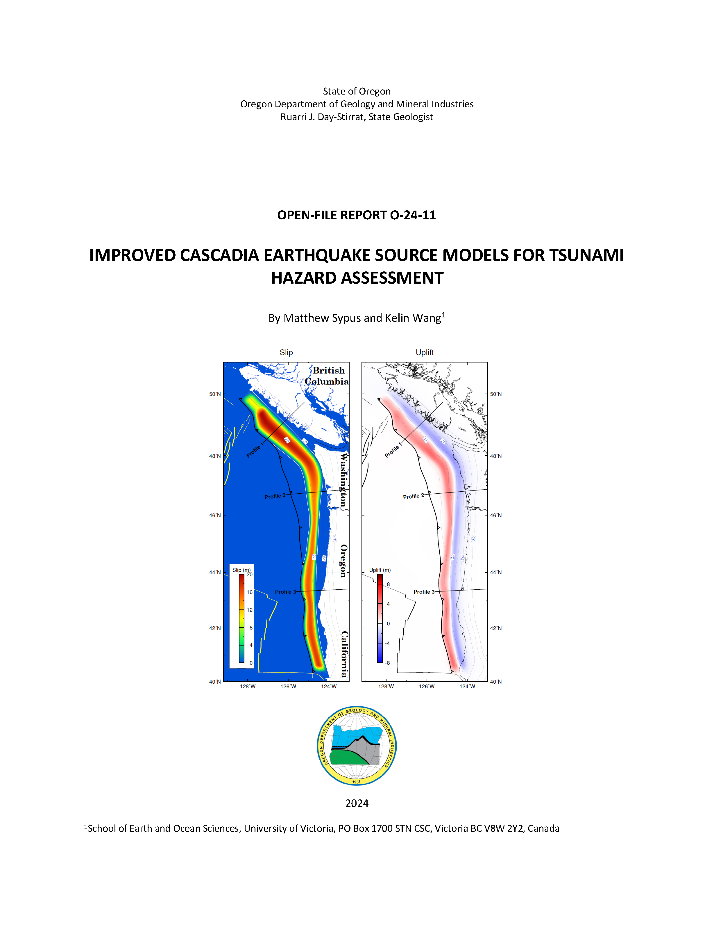
A full margin megathrust earthquake, assuming 500 years of plate convergence, highlighting both earthquake slip (left) and along-coast vertical deformation (right).